The Sweetwater Valley story
THE HISTORY OF BONITA
Kumeyaay homeland. A Mexican rancho. Citrus orchards, a landmark dam and a community determined to protect the valley it calls home.
- Community roots
- 1884
- The date commonly cited for Bonita's founding during settlement of the lower Sweetwater Valley.
- Historic rancho
- 26,632 acres
- Rancho de la Nación once covered present-day Bonita, National City, Chula Vista and the western valley.
- Water changed everything
- April 7, 1888
- Sweetwater Dam opened and made large-scale irrigation and settlement possible.
- Early landmark
- Bonita Store, 1891
- The trading post became the community's commercial center and later housed its first post office.
Era by era
HOW BONITA BECAME BONITA
Before 1769
Chapter 01
Kumeyaay homeland
Long before the name Bonita appeared on a map, the Sweetwater Valley was Kumeyaay homeland. Families moved through the river corridor seasonally, gathered plants and seeds, and used local stone for tools. The valley was a lived-in, managed landscape—not empty ground awaiting settlement.
1769–1868
Chapter 02
From presidial range to Rancho de la Nación
Spanish rule folded the valley into cattle-grazing land for the San Diego Presidio. In 1845, Mexican governor Pío Pico granted Rancho de la Nación to John Forster. The grant included what is now Bonita. After several transfers, Frank, Warren and Levi Kimball purchased the rancho in 1868 and began dividing and developing it.
1870s–1890s
Chapter 03
Orchards, water and the name Bonita
Hiram Murray Higgins planted citrus at his Bonnie Brae Ranch in the 1870s, helping establish the valley's agricultural identity. Sweetwater Dam opened in 1888, delivering the reliable water that orchards required. The Bonita Store opened in 1891, and a post office followed there in 1898—making the community name official in daily life.
January 1916
Chapter 04
The flood that reshaped the valley
After extraordinary winter storms, water overtopped Sweetwater Dam and the abutments failed. Floodwater tore through the valley, damaging rail lines, bridges, pipes and farms. The Bonita Store was damaged and moved. The masonry dam survived, but the disaster became one of the defining events in South Bay history.
1949–1960s
Chapter 05
A rural community organizes
Residents formed the Sweetwater Valley Civic Association in 1949 when a proposed highway threatened to run through the valley. Their successful effort to move the route north helped preserve Bonita's unincorporated, semi-rural character. Rohr Park was established in 1966 on land associated with the old rancho and remains a community gathering place.
Today
Chapter 06
The valley keeps its identity
Bonita grew into a suburban community, but horses, trails, mature trees and the Sweetwater River corridor still distinguish it from surrounding cities. The Bonita Museum & Cultural Center preserves more than a century of photographs, objects and oral histories—and tells the deeper Kumeyaay and rancho stories beneath the modern landscape.
Go see the story
HISTORY STILL ON THE MAP
Built 1886–1888
Sweetwater Dam & Reservoir
The masonry arch dam that made irrigated settlement possible still anchors the eastern valley. It remains a working part of the regional water system.
4355 Bonita Road
Bonita Museum & Cultural Center
The best place to explore original photographs, artifacts, exhibitions and local oral histories from Bonita and the Sweetwater Valley.
Park established 1966
Rohr Park
This public landscape occupies part of historic Rancho de la Nación and the area associated with John Forster's adobe.
Community center since 1891
Old Bonita Store site
The store served as a trading post, train stop and post office. Flood damage and later rebuilding changed the structure, but not its place in Bonita's story.
Real views of the valley
BONITA IN PHOTOGRAPHS
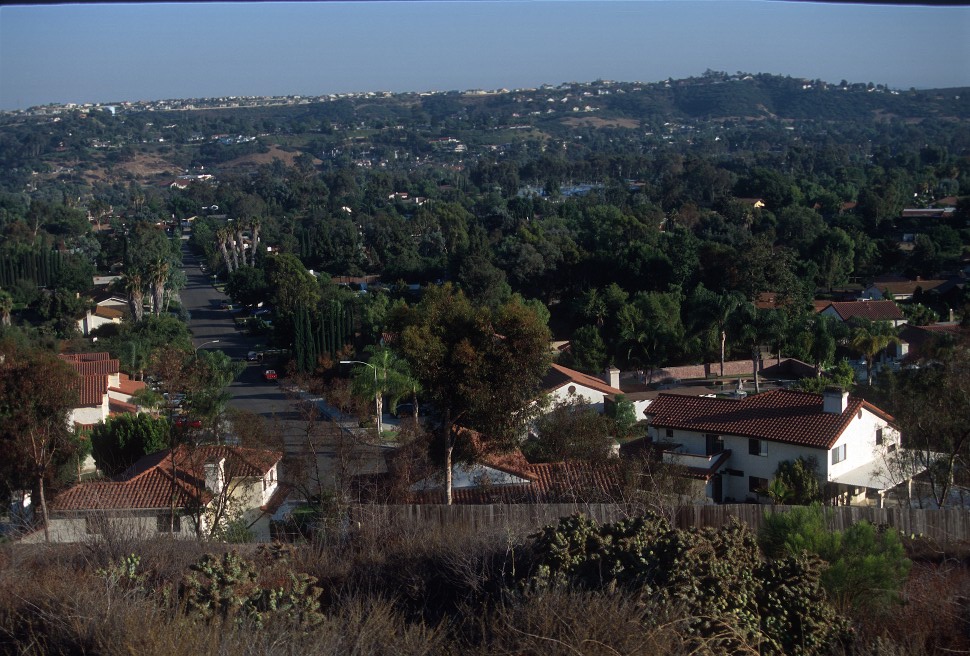
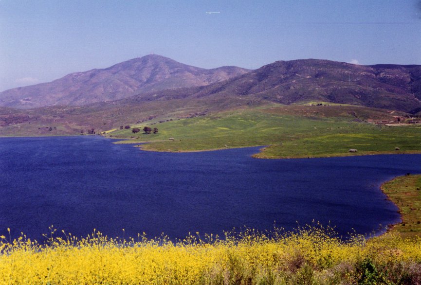
Wikimedia Commons has very few freely licensed photographs correctly identified as Bonita, California. These two verified views document the valley and reservoir without substituting images from other places named Bonita.
From the local archive
WATCH BONITA’S HISTORY
Bonita Museum exhibition video
Nuestra Frontera: Our South Bay Families at the Border
A Bonita Museum program tracing generations of Spanish-speaking families and the borderlands history shared by Bonita and the South Bay.
Bonita Museum & Cultural Center
Oscar Amezcua: Bracero Program Oral History
Barbara Zaragoza interviews Oscar Amezcua about the Bracero Program in this regional oral-history recording from the Bonita Museum.
Keep exploring
START AT THE MUSEUM
Local history changes as archives are cataloged and community members share their stories. The Bonita Museum & Cultural Center is the best starting point for exhibits, original material and deeper research.
Visit the Bonita Historical Society